-40%
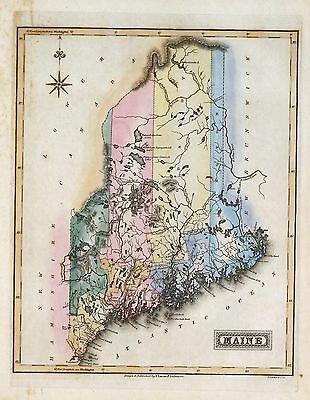
147 maps MAINE STATE history atlas antique TREASURE HUNTING old GENEALOGY DVD
$ 3.16
- Description
- Size Guide
Description
Your browser does not support JavaScript. To view this page, enable JavaScript if it is disabled or upgrade your browser.Click Here. Double your traffic. Get Vendio Gallery - Now FREE!
Rare Map Collection
This DVD is part of our Historic Map and Atlas Collection.
We have dozens of Atlas maps on DVD and CD ranging from the 1500s to the 1900s covering many areas and topics.
Please Check our Ebay Store for what's available.
FOR MANY MORE EDUCATIONAL CD TITLES
ON THIS AND MANY OTHER SUBJECTS
PLEASE VISIT OUR EBAY STORE
VERY LARGE HIGH RESOLUTION
MAP COLLECTION
ON DVD!!
(please see full table of contents and sample illustrations below)
This DVD Contains
147 Maps of
Maine
Including
25 PANORAMIC MAPS
of various Maine Cities
These are scans of the
ORIGINAL
maps by various Cartographers.
on DVD
System requirements
PC or Mac compatible.
Files are simple PDF files with a basic HTML interface (just like viewing a webpage)
Works with ALL versions of Windows.
Maps of
Maine
0028033
0041004
0073006
0089007
0102010
0149017
0151024
0152024
0278003
0285007
0352018
0358022
0536006
0537007
0565008
0586011
0594011
0845005
0874005
0887007
0966002
0966003
0966004
0966005
0985002
2336002
2369001
2436038
2468007
2483009
2501001
2542002
2694000
2721013
2844009
2862027
2866034
2905010
2964001
3164001
3167002
3441001
3544001
3565066
3803010
3888012
4520011
4534012
4557008
4577008
4578007
4584046
4587024
4628034
4727004
4807137
4825023
4850034
4862014
4863027
4864013
4865004
4866033
4869002
4966016
5028017
5041010
5198009
5363007
5479026
5745035
5755003
[Mount Desert Island and neighboring coast of Maine. Joseph Frederick Wallet)1722-1824. London, 1776?]
Maine. U.S. Coast and Geodetic Survey. 1875. MAP 1
Maine. U.S. Coast and Geodetic Survey. 1875. MAP 2
Maine. U.S. Coast and Geodetic Survey. 1875. MAP 3
Maine. U.S. Coast and Geodetic Survey. 1875. MAP 4
Maine. U.S. Coast and Geodetic Survey. 1875. MAP 5
Maine. U.S. Coast and Geodetic Survey. 1875. MAP 6
Maine. U.S. Coast and Geodetic Survey. 1875. MAP 7
Maine. U.S. Coast and Geodetic Survey. 1875. MAP 8
Maine. U.S. Coast and Geodetic Survey. 1875. MAP 9
National Wetlands Inventory, [Maine]. 1979
Coast of Maine from Rockland Harbor to Pemaquid Point.1776
Map of the railroads of the state of Maine accompanying the report of the railroad commissioners. 1899.
Map of Bar Harbor, Maine, 1904.
Map of Bar Harbor, Maine, 1896.
Plan of Bar Harbor Mount Desert Island, Maine. 1887.
Maine. Geological Survey (U.S.) 1922 Map 1
Maine. Geological Survey (U.S.) 1922 Map 2
Coast of Maine from Frenchman Bay to Mosquito Harbor. 1776
Chart of the coast of Maine 1837 Map 1
Chart of the coast of Maine 1837 Map 2
Coast of Maine from Salter Island to Portland Head. 1776
Path map of the Eastern part of Mount Desert Island Maine. 1911
Coast of Maine showing Blue Hill Bay, Penobscot Bay, Belfast Bay, Islesboro Island, Deer Island, and other islands.
Coast of Maine showing entrances of Blue Hill Bay, Isle of Haut Bay, and Penobscot Bay, with Owls Head, Vinalhaven Island, Isle au Haut, and other islands.
A map of the sources of the Chaudière, Penobscot, and Kennebec rivers, by Montresore. 1761?
Coast of Maine showing entrances of Blue Hill Bay, Isle of Haut Bay, and Penobscot Bay, with Owls Head, Vinalhaven Island, Isle au Haut, and other islands. 1776?
Acadia National Park, Maine, official map and guide / National Park Service, U.S. Department of the Interior. 1989.
Coast of Maine from Mosquito Head to Spurwink River.
Birds eye view of the villages of New Castle & Damariscotta, Lincoln Co., Maine, 1878
Bird's eye view of Gardiner and Pittston, Kennebec Co., Maine, 1878
Plan of 50 townships to be sold by lottery lying between the rivers Penobscot & Schoodic.
Map of Mount Desert Island, Maine. 1917
Acadia National Park and vicinity, Hancock Co., Maine. 1971
Maine, Hancock County, Acadia National Park and vicinity. 1935
Topographic Map, Acadia National Park, Hancock County, Maine. 1931
Map of Mount Desert Island. 1887
Topographic map, Acadia National Park and vicinity, Hancock County, Maine. 1956
Dixfield, Maine, 1896.
Map of Mount Desert Island and the coast of Maine.
A Plan of the late Province of Main as far as Kennebeck River. 1778
Historic resource study for the carriage road system, Acadia National Park, Mount Desert Island, Maine / prepared for U.S. Department of the Interior, National Park Service, North Atlantic Regional Office ; prepared by William D. Rieley and Roxanne S. Brouse, Rieley & Associates, Landscape Architects.
Bird's eye view of Eastport, Washington Co., Maine.
Presque Isle, Aroostook County, Maine.
Part of Oxford and Cumberland counties, Me. Drawn by S. Greenleaf.
Sieur de Monts National Monument, Mount Desert Island, Maine.
Sanford, Maine. Burleigh Lith. Est. 1889
Livermore Falls, Maine. Burleigh Lith. Est. 1889
North Berwick, York Co., Maine 1877.
Pittsfield, Maine. Burleigh Lith. Est. 1889.
The above plan is a discription of a new township called Royalsborough in the county of Cumberland, bounded southeasterly on the headline of Brunswick, southwesterly on Northyarmouth, northwesterly on proprietors land, northeasterly on Androscoggin River ... attest. Joseph Noyes, survayor. Deld. Falmouth, May 22nd, 1766.
Blue Hill, Maine, 1896.
Richmond, Sagadahoc Co., Maine 1878.
Bird's eye view of the city of Hallowell, Kennebec Co., Maine 1878
Bird's eye view of the City of Bangor, Penobscot County, Maine, 1875
Birds eye view of the village of Wiscasset, Lincoln Co., Maine, 1878
Bar Harbor, Mt. Desert Island, Maine. Geo. H. Walker & Co. Lith.
South Berwick, York Co., Maine, 1877 / Jos. B.. Richards & Co. Lith., Boston, Mass.
Bridgton, Maine, U.S.A. : 1888 / the Burleigh Lith. Est.
Peak's Island, Portland harbor, Maine. Geo. H. Walker & Co. lith.
Monson, Maine. Drawn & published by Geo. E. Norris. The Burleigh Lith. Est. 1889
Guide map of Acadia National Park / United States Department of the Interior, National Park Service. 1954
Bird's eye view of the city of Portland, Maine 1876. Jos. Warner, artist. Chas. Shober & Co. prop's Chicago Litho'g. Co.
Bird's eye view of Great Falls, Strafford Co., New Hampshire & Berwick, York Co., Maine 1877. A. Ruger del. C.H. Vogt & Co. Lith.
Monhegan, Me. 1886
Houlton, Me. Aroostook County seat.
Wilton, Me. 1895
Machias, Me., 1896
Plan of Fort Pownal at Penobscot built 1759.
Kingfield, Me., Franklin Co., 1895.
A Map of 100 miles round Boston. 1775
Map of the Portsmouth and Concord Railroad, shewing its connection with other railroads. T. J. Carter, engineer. On stone by J. E. Moody. 1845
The above plan is a discription of a new township containing the quantity of seven and a half mile of land & water, granted by the General Court to the proprietors of Bakerstown so call'd, lying & being in the county of Cumberland ... Deld. at Falmouth, 4th September 1765. Attest. Joseph Noyes, surveyr.
Penobscot River and Bay, with the operations of the English fleet, under Sir George Collyer, against the division of Massachusetts troops acting against Fort Castine, August 1779; with full soundings up to the present site of Bangor.
Features of this DVD
This auction is for a DVD of the maps listed in electronic form,
NOT
the maps themselves.
These maps are VERY high resolution and can be printed at FULL SCALE or LARGER for framing and display. The results are very high quality and convincing.
Ad and disk copyright 2013
Euriskodata
All Rights Reserved
Powered by
eBay Turbo Lister
The free listing tool. List your items fast and easy and manage your active items.


